
Researchers at the International Centre of Insect Physiology and Ecology (icipe) in Kenya are using advanced satellite imaging data to improve food security. According to the U.N. Food and Agriculture Organization, East Africa currently faces the greatest burden of acute food insecurity globally. Across the continent, nations continue to face substantial food crises driven by climatic fluctuations including drought and flooding as well as economic pressures like high food and fertilizer prices.
“Accessibility is the first step towards governance,” Tobias Landmann, Senior Research Scientist at icipe, tells Food Tank. “If you want to be independent of the Global North, you must have control over that analysis-ready data.”
icipe recently assumed full ownership and operation of the geospatial observation platform Digital Earth Africa (DEA). “This transition represents a powerful step toward sustained African ownership, ensuring the program continues to deliver critical Earth observation data and insights for the continent,” remarks Lisa-Maria Rebelo, Managing Director of DEA.
“icipe has an African mandate, working in all 54 countries to provide bio-efficient, biological solutions to farmers,” Landmann tells Food Tank. “[DEA] coming to icipe underpins that concept because now we can use big data that’s co-developed in Africa for Africa.” Originally launched in 2019, DEA has been independently governed by organizations including the U.N. Economic Commission for Africa as well as the African Regional Institute for Geospatial Information Science and Technology.
By working with entirely Africa-led data, the platform completely changes how continental trends are studied. Containing some of the most ecologically diverse regions on Earth, Africa offers an unparalleled frontier for geospatial and topographic analysis, providing food system researchers and actors with the comprehensive data needed to safeguard community ecosystem health.
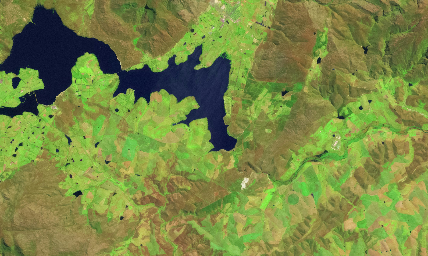
The Waterbodies Continental Service, for example, monitors over 750,000 water bodies across the continent with a minimum spatial resolution of 10 meters. As a part of DEA, this high-resolution imaging data allows researchers to track variables including nutrient enrichment across streams, rivers, and lakes as well as the proliferation of invasive plant species.
“Prosopis juliflora is an invasive shrub that we are mapping in Kenya and Ethiopian drylands. The shrub is basically invading all the water bodies, impeding biodiversity, aggravating drought… we don’t know where the intervention areas are,” explains Landmann. He notes that the platform’s analysis-ready data is designed directly to improve policy reporting. But because the African continent is dominated by small farms, the degree to which satellite imaging can improve agricultural productivity is context-dependent.
An FAO report finds that nearly 75 percent of all farm holdings in sub-Saharan Africa are two hectares or less—with just over half of all farms less than a single hectare. “We run a procedure based on Earth observation satellite data to see the deficiencies unique to certain [crop] fields,” states Landmann. “And that is a challenge because very often the fields are very small, smaller than the minimum mapping unit.”
“The most important stressor [icipe] can map is actually drought, water deficiency, or in irrigation terms, ‘water use inefficiency’ or deficits,” says Landmann. Extreme weather events such as El Niño can exacerbate drought and flooding across different parts of Africa, meaning that having up-to-date, accurate satellite imaging is crucial to analyze the spatiotemporal effects of such events on African farms.
“We scaled a very unique concept that was actually developed by Digital Earth Australia and then transferred to Africa called ‘geo-medians.’ So, our geo-medians are legendary. It’s a game changer,” says Landmann.
Geo-medians work by stitching together images captured by satellites at different times. This means that even when cloud cover obstructs a single photo, researchers still have a clear view of the entire landscape.
According to Landmann, policy frameworks and regional actors can immediately ingest this perfectly harmonized, long-term historical data into their systems. This allows them to bypass complex pre-processing and efficiently track macro-trends like deforestation, crop intensification, or changing water cycles over several years to inform long-term climate legislation.
Beyond agriculture, satellite data can also help researchers monitor water quality, air quality, urbanization trends, biodiversity loss, carbon neutrality, and value chains, Landmann adds. “There are so many kinds of use cases that you wouldn’t necessarily think about. There’s always a bias towards agriculture and food systems, which is understandable, but multiple thematic areas can benefit from this great data set.”
Articles like the one you just read are made possible through the generosity of Food Tank members. Can we please count on you to be part of our growing movement? Become a member today by clicking here.
Photo courtesy of U.S. Geological Survey